A Night of Escalating Warnings in the Heartland
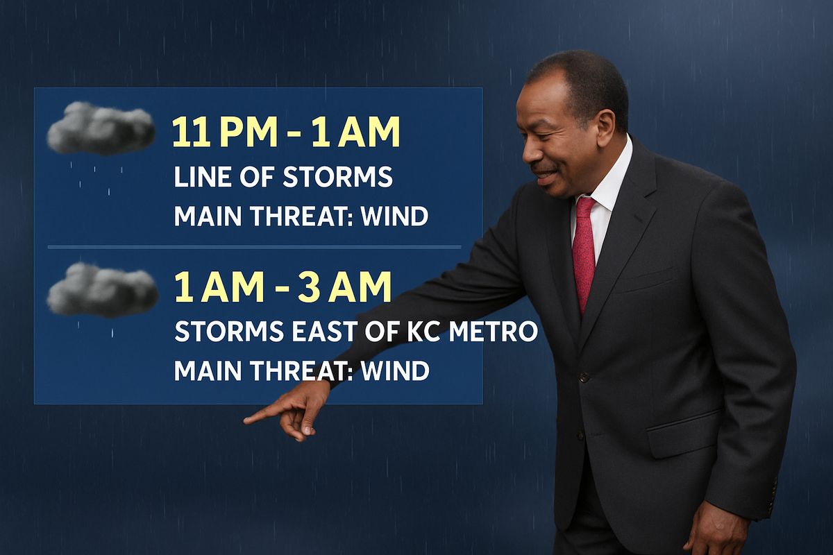
On the evening of Friday, March 6, 2026, the Kansas City metropolitan area and a broad swath of surrounding counties in Missouri and Kansas braced for a significant severe weather event. The forecast, detailed by KMBC's First Alert Weather team, warned of two distinct rounds of severe thunderstorms capable of producing large hail, damaging wind gusts, and tornadoes. The situation evolved rapidly throughout the night, with the National Weather Service issuing a cascade of watches and warnings that painted a vivid picture of a volatile atmosphere. The core threat shifted later into the evening and overnight hours, tied to the approach of a potent cold front, transforming what began as a monitored risk into an active, multi-jurisdictional weather emergency.
The timeline of alerts, as documented in the KMBC Weather Blog, reveals the event's progression. Initial concerns focused on areas to the south and east of the metro, with a Tornado Watch issued for Bates and Henry Counties in Missouri at 5:49 p.m. CST. By 7:26 p.m., the watch was extended northward to include Cass, Cooper, Johnson, Lafayette, Pettis, and Saline Counties. The pivotal escalation came at 8:19 p.m. when the National Weather Service issued a Tornado Watch encompassing the core Kansas City metro area, including Jackson, Clay, Platte, and Johnson counties, effective until 4 a.m. on Saturday, March 7. This set the stage for a long night of monitoring as the cold front advanced.

Decoding the Meteorological Setup: Why Two Rounds?
The forecast for two rounds of severe thunderstorms is not merely dramatic phrasing; it reflects a specific and dangerous meteorological pattern. The first round, anticipated earlier in the evening, was associated with discrete storm cells firing ahead of the main front. These isolated storms, like the one that prompted a Severe Thunderstorm Warning for Linn County, Kansas, and Bates County, Missouri, at 7:10 p.m., can be particularly potent tornado producers if the atmospheric shear—the change in wind speed and direction with height—is strong enough.
The second, and ultimately more significant, round was driven by the cold front itself. As First Alert Meteorologist Nick Bender indicated in the 3:50 p.m. update, the highest probability for severe weather was expected with the front's arrival after sunset. This linear forcing can organize storms into squall lines or bow echoes, which are notorious for producing widespread damaging straight-line winds, sometimes exceeding 80 mph, and embedded tornadoes. The front's timing, pushing through in the overnight hours, added a critical layer of danger, as tornadoes occurring at night are statistically more than twice as deadly due to reduced visibility and the likelihood people are asleep.
Anatomy of a Warning: From Watch to Expiration
The source material provides a real-time ledger of the event's peak activity, offering a case study in how severe weather unfolds and is communicated. The flurry of warnings after 11 p.m. CST demonstrates the front's impact on the immediate metro area. At 11:24 p.m., a Severe Thunderstorm Warning was issued for Buchanan, Clay, Clinton, and Platte Counties in Missouri. Minutes later, at 11:26 p.m., another warning expanded the threat to include Clay, Jackson, Johnson, and Platte in Missouri, and Johnson, Leavenworth, and Wyandotte in Kansas.
The most severe alert came at 11:36 p.m.: a Tornado Warning for Jackson County, Missouri, Johnson County, Kansas, and Wyandotte County, Kansas, valid until midnight. This indicated that radar showed strong rotation within the storm cell, posing an immediate threat to life and property. The warning was allowed to expire at 11:52 p.m., but simultaneously, a new Severe Thunderstorm Warning was issued for Clay, Jackson, Lafayette, Platte, Ray, and Wyandotte counties until midnight, confirming the line of storms remained powerful. The blog's final update at 11:52 p.m. noted the severe threat had "lessened to some extent," but conditions remained unsettled as the front continued its push.
The Role of the First Alert Weather Team
Coverage was led by KMBC's First Alert Chief Meteorologist Bryan Busby and First Alert Meteorologist Nick Bender. Their blog served as a critical hub, synthesizing raw National Weather Service data into actionable, geographically specific information for viewers. By labeling the day a "First Warn Weather Day," they signaled heightened risk well in advance, priming the public for the potential of dangerous weather. This proactive communication is a cornerstone of modern broadcast meteorology, bridging the gap between federal alerts and local preparedness.
Historical Context: Severe Weather in the Kansas City Region
The threat of severe thunderstorms and tornadoes is a perennial feature of life in the Plains and Midwest, with Kansas City situated in a vulnerable corridor. Events like the March 2026 outbreak are part of a long climatological history. While the source material does not provide specific historical comparisons for this event, the pattern of a strong spring cold front triggering severe weather is classic for the region. Historically, March can be a volatile transition month, where lingering winter cold clashes with increasing Gulf moisture, creating the instability needed for powerful storms.
The communication protocols seen here—the tiered system of watches (conditions are favorable) and warnings (danger is imminent)—were forged through tragic events of the past. The modern radar network and warning system are direct responses to historic outbreaks, emphasizing the life-saving value of precise, timely information. The ability to issue warnings for specific counties with lead times of 15-45 minutes, as demonstrated in the blog, represents a monumental advance from the broader, less specific alerts of decades past.
Why It Matters
While major news outlets will report the facts of warnings, hail size, and storm paths, the deeper implication of an event like this lies in the evolving nature of severe weather risk and public response. The March 2026 scenario underscores a critical, often-missed trend: the increasing frequency of nocturnal severe weather and its compounding dangers. As atmospheric patterns shift, the diurnal timing of peak storm intensity may be changing, placing more people at risk during the most vulnerable hours. This necessitates a fundamental shift in preparedness, moving beyond having a plan for when you're awake and near a TV, to ensuring alert systems can reliably rouse households in the dead of night.
Furthermore, this event highlights the gap between meteorological precision and public perception. The forecast for "two rounds" is highly accurate from a modeling perspective, but it can inadvertently lead to complacency if the first round is underwhelming. The KMBC blog explicitly addressed this, noting at 5:30 p.m. that the early evening risk had weakened but the primary threat with the cold front later was still on track. This kind of nuanced communication is essential to combat "warning fatigue" and ensure the public maintains vigilance through a prolonged threat period. It connects to the broader challenge in an era of climate change: conveying complex, multi-phase weather hazards in a way that prompts appropriate and sustained action.
Readers should think differently about what a "severe weather threat" means. It is not a single, discrete event but often a hazardous weather *process* that unfolds over many hours. The key takeaway is to trust the entire forecast timeline, not just the current radar snapshot. Because of this, individuals and families must prepare for a sheltering event that could last much longer than a few minutes, with power outages and blocked roads a real possibility between storm rounds. The real lesson is that resilience is built on understanding the *process* of the storm, not just reacting to its most immediate signature.
What to Watch For Going Forward
In the immediate aftermath of this event, residents in the affected counties should remain cautious. Even as the Tornado Watch expires, the passage of a strong cold front can lead to rapidly falling temperatures, gusty winds, and the potential for residual flooding if heavy rainfall occurred. Damage assessment from large hail and straight-line winds will be a priority for local emergency management officials.
Looking at the broader pattern, this early March event serves as a potent reminder that the severe weather season is underway. Residents across the Midwest and Plains should take this opportunity to review and practice severe weather safety plans. Key actions include: identifying the safest room in your home (an interior room on the lowest floor, away from windows), ensuring multiple reliable methods for receiving warnings (NOAA Weather Radio, smartphone emergency alerts, and trusted local media like First Alert Weather), and having an emergency kit ready. Special attention should be paid to plans for nighttime events, such as making sure alert volumes are turned up and that everyone in the household knows where to go quickly if a warning is issued while asleep.
The performance of warning systems and community response during this dual-round event will provide valuable data for meteorologists and emergency planners. Analyzing how the storms evolved versus predictions, and public response to the warnings, can help refine future forecasts and communication strategies, ultimately enhancing community resilience for the next severe weather threat.