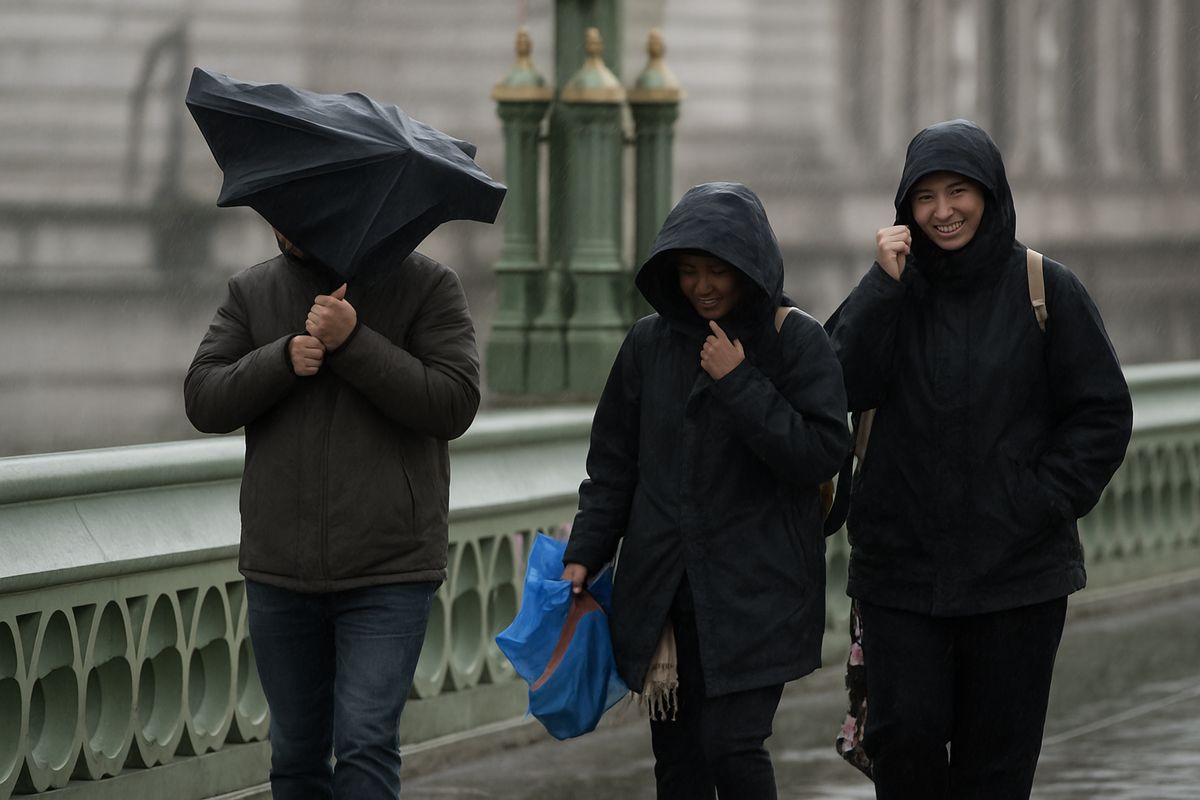
A Sudden Shift: Spring Warmth Gives Way to Winter's Grasp
After a period of unseasonably mild and spring-like conditions, the UK is bracing for a significant and abrupt return to wintry weather. Forecasters from the Met Office and the BBC are warning of a dramatic shift from Thursday, 12 March 2026, onwards, bringing with it a potent mix of heavy rain, severe gales, and the chance of snow for many regions. This marks a stark reversal from the recent warmth, where temperatures had climbed into the mid-teens Celsius, and serves as a potent reminder of the volatile nature of British weather in early spring.
The change is being driven by a fundamental reconfiguration of the atmospheric patterns over the North Atlantic. According to BBC Weather presenters Tomasz Schafernaker and Simon King, the jet stream is "ramping up," funnelling a succession of deep low-pressure systems and active weather fronts directly towards the British Isles. This will sweep away the lingering mist and fog that has characterised recent days, replacing it with increasingly wet and windy conditions. The core of the cold is expected to arrive on Friday, 13 March, when a marked shift to a north-westerly wind direction will drag Arctic air southwards across the country, plunging temperatures to around three or four degrees below the seasonal average.

The Forecast Timeline: From Gales to Snow Showers
The incoming unsettled spell will arrive in distinct phases, each bringing its own hazards. The initial impact will be felt in Scotland on Wednesday, 11 March. A deep area of low pressure to the north will bring strengthening winds, with gusts of 70-80 mph (110-130 km/h) possible in northern and western Scotland. The Met Office has issued a yellow severe weather warning for this region from 00:00 to 12:00 GMT, warning of potential disruption to transport, including bridge restrictions and ferry cancellations.
By Thursday, the strong winds will become more widespread across the UK, with gusts of 40-50 mph (65-80 km/h) expected widely. Western coasts of England and Wales could see gusts up to 60 mph (97 km/h), while northern and western Scotland may still experience gusts of 65 mph (105 km/h). This will coincide with outbreaks of heavy rain, particularly over western hills, where the Lake District could see up to 50mm of rainfall. Jason Kelly, Chief Operational Meteorologist for the Met Office, stated: "A notable shift in wind direction to a north-westerly flow will bring a markedly colder day nationwide on Friday."
The Cold Peak and Wintry Hazards
Friday, 13 March, is pinpointed as the day when winter makes its most pronounced return. The combination of plunging temperatures and strong winds will create a significant wind chill, making it feel much colder than the thermometer suggests. The weather will become showery, with these showers turning increasingly wintry. Fast-moving hail showers are possible almost anywhere, and brief flurries of wet snow are "not out of the question, even in the south," according to the BBC, though settling snow is unlikely at lower levels in southern Britain.
The main accumulations of snow are expected on the mountains and higher ground of Scotland, Northern Ireland, and northern England. There is also the possibility of some snow on hills in Wales and southwest England. Joanna Robinson, Sky News's weather producer, added: "Friday will bring showers, with snow down to relatively low levels in the north, especially early on." The weekend looks to remain cold initially, with frosty overnight conditions bringing a risk of icy stretches, before temperatures slowly recover to near average by early next week as high pressure attempts to build.
Understanding the Drivers: The Jet Stream and Arctic Air
To comprehend why this sudden cold snap is occurring, one must look to the behaviour of the jet stream—a core of strong winds high in the atmosphere that steers weather systems. In recent weeks, its path has allowed milder Atlantic air to dominate. The forecast change, as illustrated by the BBC Weather team, is due to "dips in the jet stream" that will allow colder Arctic air to spill southwards across the UK. This is a classic setup for bringing wintry conditions in spring, when the sun's strength is increasing but the air masses to the north remain profoundly cold.
The source regions for this cold air are critical. While the UK basked in relative warmth, the air over the far northern Atlantic has remained frigid. The developing weather pattern is essentially acting as a conveyor belt, progressively transporting this cold air southeastwards. The succession of low-pressure systems intensifies this process, creating strong pressure gradients that result in the forecast gales. This interplay between the position of the jet stream, the temperature of source air masses, and the track of low-pressure systems is the fundamental meteorology behind the forecast disruptive spell.
Historical Context and Seasonal Normality
While the abrupt shift may feel surprising after a taste of spring, significant cold snaps in March are far from unusual in the UK's climatic history. Statistically, March is a transitional month where the battle between retreating winter cold and advancing spring warmth is often at its most volatile. The Met Office and other climatological records are replete with examples of heavy snowfalls occurring well into March and even April. This forecast event, therefore, fits within the expected range of variability for the time of year.
This point is underscored by the BBC's own analysis, which notes it is "typical to get big swings in weather at this time of year." The recent mild spell, potentially influenced by broader atmospheric patterns or residual warmth from a wet winter, created a false sense of seasonal security. The return to colder conditions serves as a corrective, aligning more closely with the long-term average expectations for early-to-mid March. It highlights the danger of extrapolating a week or two of pleasant weather into a permanent seasonal shift, especially in a climate as famously changeable as Britain's.
The Bigger Picture: Volatility, Perception, and a Changing Climate
This impending cold snap arrives against a backdrop of a notably wet winter for parts of the UK, which the Met Office has confirmed was the wettest on record for some regions. This context is crucial. The saturated ground from months of rainfall, as highlighted in related coverage of an "extremely frustrating" grassroots football season, means that the forecast heavy rain has a heightened potential for causing localised flooding and travel disruption. The weather does not occur in isolation; each event interacts with the legacy of previous conditions.
Furthermore, this event engages with the complex public perception of weather within the narrative of climate change. A single cold spell does not contradict the long-term trend of global warming; in fact, some research suggests that a warming Arctic can contribute to a more wavy and disrupted jet stream, potentially leading to more frequent incursions of cold air into mid-latitudes during winter and spring. This forecast period of wintry weather is a weather event, driven by short-term atmospheric mechanics. However, it occurs within a climate system where the baseline conditions—such as sea surface temperatures and atmospheric moisture content—are altered, which can influence the intensity of rainfall associated with storms, even if their temperature profile is cold.
This serves as a reminder that a changing climate manifests not just as straightforward warming, but as an increase in weather volatility and extremes. The swing from spring-like warmth to winter cold, the intense rainfall following a record-wet season, and the potential for disruptive gales all point to a pattern of heightened energy in the weather system. For infrastructure, agriculture, and daily life, adapting to this increased variability may become as important as adapting to gradual changes in average temperature.
Preparedness and Looking Ahead
For the public, the key advice from forecasters is to stay updated with the latest forecasts and warnings. The specifics of snow accumulation, particularly at lower levels, will become clearer as the event approaches. Residents, especially in northern and western areas, should be prepared for potential travel disruption on Wednesday due to wind and later in the week due to rain and wintry showers. The risk of overnight frosts and ice, particularly on Saturday morning, also warrants caution for early travellers.
Looking beyond the weekend, the signal is for conditions to calm down as an area of high pressure attempts to build. However, as we remain in early spring, further unsettled and potentially cold spells are always a possibility. The UK's weather is entering its most unpredictable phase, where sunshine, showers, gales, and snow can all occur within a matter of days. This forecast event is a textbook example of that springtime volatility, a reminder that winter often relinquishes its grip reluctantly, and that in the British Isles, no seasonal shift is ever a straight line.